
Survey Unit
- You are required to bring the following documents with you regarding your first visit to the Survey Unit in LMD, Bairiki:
1. Boundary Determination Court Minutes
2. Survey Fee $33.75 (pay at finance and retain receipt)
3. Certificate of land ownership
NB: If you do not have these, we cannot assist you.
Please do assure to bring legal documents
When you bring a complete documents the processing on it will only took one day.
Senior Land Surveyor
We record your receipt number, court minutes, and any other relevant information about your land.
A Senior Land Surveyor (under the director of Chief Land Surveyor, CLS, or Officer in Charge, OIC) is responsible for the weekly workplan. During this process a date will be decided for your survey to be carried out.
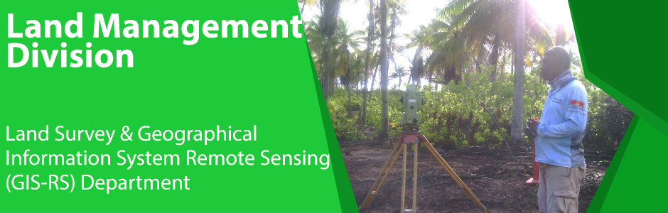
Survey Team Onsite
Under the Native Lands Ordinance, Section 22, surveyors may at all reasonable times enter and remain on any land he/she is required to by or under any Ordinance, by any Court or Chief Land Surveyor to survey or mark out, and upon any neighbouring land
Other Services Provided:
1) Cadastral Survey: -Boundary reinstatement, reinstall, redefine,
2) Topographical survey: - Obtaining heights of existing Land features including; Buildings, High water marks, and vegetation (trees),
3) Any project requiring Survey assistance,
4) Levelling / Height and Elevation (Contouring).
Logged into GIS and Survey Section Database
GIS RS Unit (Geographic Information System and Remote Sensing Unit)
First of all our job is computer based as it requires certain software in order to carry out the job. We’ve been known as GIS users because we use GIS (Geographic Information System) for our daily job. GIS is a computer system that can display, compute, analyze, gather and manage data.
Therefore, our major job here at Land Management Division is to:
Map or draw Government Lease and Sublease diagrams for agreement purposes.
Map the results of land boundary surveys for private and court requirements purposes (Cadastral Mapping).
Creating our own data by using Satellite Imageries for updating buildings, roads, coastline, ponds, and etc. This is very important for our baseline data to determine changes from time to time. Digitizing is the only method for acquiring data from Satellite and Drone Images.
Use very old data especially aerial photographs; by rectify them to match with the coordination system used for our current baseline data. This is only when the court or the public need to look on the old data to compare with the recent one.
Public Customer Service are categorized below
Issue map of Government Lease, Sublease and Private Lands.
Fill in the FMC form (Foreshore Management Committee) and issue map for customers who wanted to build seawalls.
Fill in the Building Permit Form and issue map for customers who wanted todevelop building, fences and any other infrastructural development within TUC and BTC.
We assist in court hearings and cross examines when the public or the government needed us.
We can analyze other datasets (Not Lands Data), like dataset for health, Education and etc that require more display clearer. Most of those datasets aresaved, stored, displayed and analyzed in Excel Spreadsheet but when it is convertedinto map then it would be clearer and easier than in spreadsheet.
Any other mapping needs from the public and the government.
Other Services Provided:
1) Coastal Change Detection.
2) Change Detection for Land Vegetation.